DALMAC 2004 ROUTES
| The DALMAC Quad Century ran September 2 to 6 over some of
Michigan's finest roads under its finest skies. This year marked one
of the most significant alterations of the route in the past 20
years. Rather than taking a snaking bee line to the bridge from
Lansing, it went out of its way to show the riders some spectacular
terrain in the Northwest part of the state, most notably between LeRoy and
Mesick. The reputation of "The Wall" remains in tact but
the real high point of the ride is elsewhere!
These profiles show the elevation of each day's ride and were generated
with XMap 4.5 and Topo USA by DeLorme. The profiles are extremely
accurate and because of the accuracy and the scale, hills often look like
mountains. Use the picture, the elevation readings on each chart, and the
statistics at the bottom of each to best judge each day's
ride. |
Day 1 Lansing to Morely-Stanwood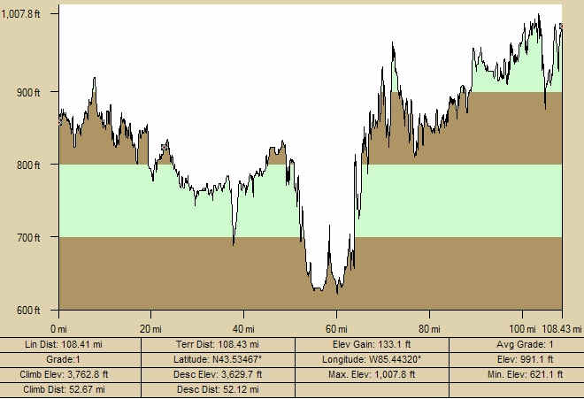 |
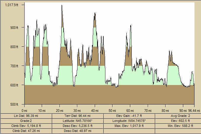
| Day 2 Morely Stanwood to Mesick (End of White Pine to Mesick only) 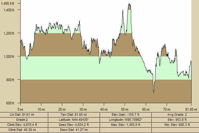
|
Day 3 Mesick to Torch Lake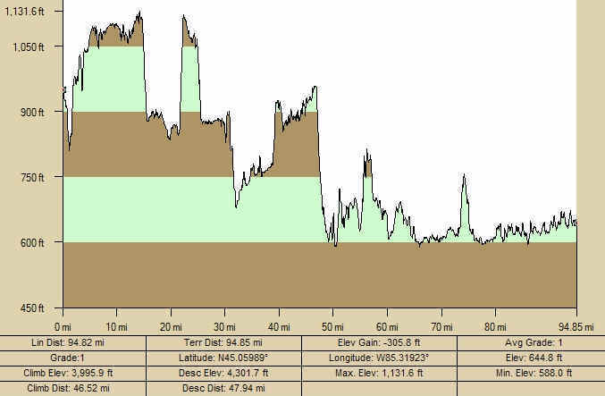 |
| Day 4 Torch Lake to Mackinaw City
|
|
All mapping courtesy of Geographic
Insights, a Lansing based firm specializing in market analysis,
management systems, and geographic displays. Images may be freely
shared with attribution to Geographic Insights (Including a hyperlink if
displayed on a web page). |